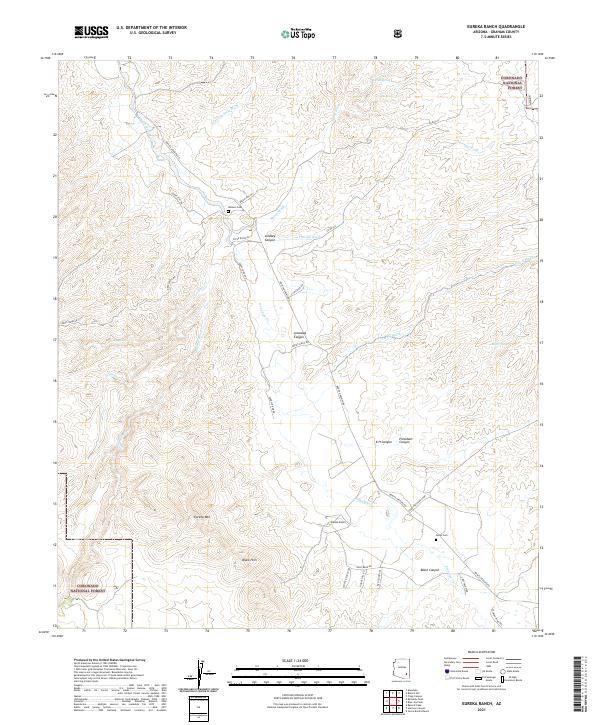
2021 Map of Eureka Ranch
USGS Topo · Published 2021About this map
Eureka Ranch serves as a central landmark in this high-desert landscape of Graham County, where the topography is defined by the dramatic descent into Aravaipa Canyon and Black Canyon. The terrain is characterized by a complex network of seasonal drainage systems, including Kennedy Falls Wash, Sheep Wash, and Fresnal Wash, which feed into the larger course of Aravaipa Creek. For family historians and local researchers, the map identifies small, significant sites such as Whalen Cem and Johns Cem, resting among the prominent heights of Eureka Mtn and the Black Hills. This modern survey records the enduring ranching and conservation character of the region, much of which is protected within the Coronado National Forest. A network of named dirt routes like Bonita Aravaipa Rd and Paddy Lynch Rd provides the primary access through these remote canyons and upland flats.
Find a feature on this map
78 named features on this map. Tap any name to fly to it.
Don’t see what you’re looking for? This feature index may not catch every label — zoom into the map to look around manually.
Map Details
Editions of this 2021 Eureka Ranch Map
This is the sole edition of this map. No revisions or reprints were ever made.
Other maps of this area

1938 · Galiuro Mts
USGS Topo · 1:48,000

1938 · Klondyke
USGS Topo · 1:48,000

1940 · Sierra Bonita Ranch
USGS Topo · 1:62,500

1942 · Sierra Bonita Ranch
USGS Topo · 1:62,500

1943 · Galiuro Mts
USGS Topo · 1:62,500

1943 · Klondyke
USGS Topo · 1:62,500

1943 · Sierra Bonita Ranch
USGS Topo · 1:62,500

1944 · Jackson Mtn.
USGS Topo · 1:62,500

1946 · Jackson Mtn.
USGS Topo · 1:62,500

1956 · Tucson
USGS Topo · 1:250,000