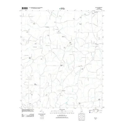
2011 Map of Eva
USGS Topo · Published 2011About this map
Eva and the surrounding highlands of northern Cullman County are defined by a complex network of ridges and deep drainage hollows that feed the Tennessee River watershed. The community of Union Hill and the Eva Post Office serve as central points for a rural landscape punctuated by numerous family and community burial grounds, including the Macedonia and Childers sites near Oden Ridge. This 2011 survey illustrates how modern road networks like Eva Rd and Co Rd 1435 trace the ancient topography, winding around features such as Cook Gap Mountain and Hale Mountain.
Find a feature on this map
184 named features on this map. Tap any name to fly to it.
Don’t see what you’re looking for? This feature index may not catch every label — zoom into the map to look around manually.
Map Details
Editions of this 2011 Eva Map
This is the sole edition of this map. No revisions or reprints were ever made.
Other maps of this area

1888 · Cullman
USGS Topo · 1:125,000

1892 · Cullman
USGS Topo · 1:125,000

1927 · Falkville
USGS Topo · 1:24,000

1936 · Hartselle
USGS Topo · 1:24,000

1936 · Eva
USGS Topo · 1:24,000

1936 · Somerville
USGS Topo · 1:24,000

1936 · Lawrence Cove
USGS Topo · 1:24,000

1936 · Center Grove
USGS Topo · 1:24,000
1947 · Center Grove
USGS Topo · 1:24,000

1949 · Falkville
USGS Topo · 1:24,000