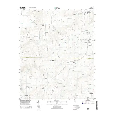
2014 Map of Eva
USGS Topo · Published 2014About this map
Brindley Mountain and the Tennessee Valley Divide dominate the topography of this north Alabama landscape, marking the boundary between the Morgan and Cullman county line. The map captures a transition from the elevated plateaus near Oden Ridge and Union Hill down into the creek-carved hollows of the south, such as Parker Hollow and Stillhouse Hollow. Settlement patterns are defined by small crossroads like Eva and Providence, with numerous family-named landmarks and cemeteries scattered throughout. The southern portion of the sheet shows the development of the Cullman Regional Airport-Folsom Field and the waters of Lake Catoma, illustrating how modern infrastructure has integrated with the established rural geography. These details, from the Hale Bridge over Lick Creek to the various springs like Dripping Spring, provide a precise record of the area's physical and cultural layout.
Find a feature on this map
171 named features on this map. Tap any name to fly to it.
Don’t see what you’re looking for? This feature index may not catch every label — zoom into the map to look around manually.
Map Details
Editions of this 2014 Eva Map
This is the sole edition of this map. No revisions or reprints were ever made.
Other maps of this area

1888 · Cullman
USGS Topo · 1:125,000

1892 · Cullman
USGS Topo · 1:125,000

1927 · Falkville
USGS Topo · 1:24,000

1936 · Hartselle
USGS Topo · 1:24,000

1936 · Eva
USGS Topo · 1:24,000

1936 · Somerville
USGS Topo · 1:24,000

1936 · Lawrence Cove
USGS Topo · 1:24,000

1936 · Center Grove
USGS Topo · 1:24,000
1947 · Center Grove
USGS Topo · 1:24,000

1949 · Falkville
USGS Topo · 1:24,000