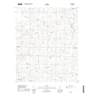
2018 Map of Eva
USGS Topo · Published 2018About this map
The Tennessee Valley Divide cuts across this landscape, marking a significant hydrologic boundary between the north-flowing waters of E Fork Flint Cr and the southern drainage heading toward Lake Catoma. This terrain is defined by a series of named hollows and ridges, including Stillhouse Hollow, Martin Hollow, and Negro Mountain, which provided the physical structure for a network of rural communities such as Union Hill, Providence, and Enon.
Find a feature on this map
140 named features on this map. Tap any name to fly to it.
Don’t see what you’re looking for? This feature index may not catch every label — zoom into the map to look around manually.
Map Details
Editions of this 2018 Eva Map
This is the sole edition of this map. No revisions or reprints were ever made.
Other maps of this area

1888 · Cullman
USGS Topo · 1:125,000

1892 · Cullman
USGS Topo · 1:125,000

1927 · Falkville
USGS Topo · 1:24,000

1936 · Hartselle
USGS Topo · 1:24,000

1936 · Eva
USGS Topo · 1:24,000

1936 · Somerville
USGS Topo · 1:24,000

1936 · Lawrence Cove
USGS Topo · 1:24,000

1936 · Center Grove
USGS Topo · 1:24,000
1947 · Center Grove
USGS Topo · 1:24,000

1949 · Falkville
USGS Topo · 1:24,000