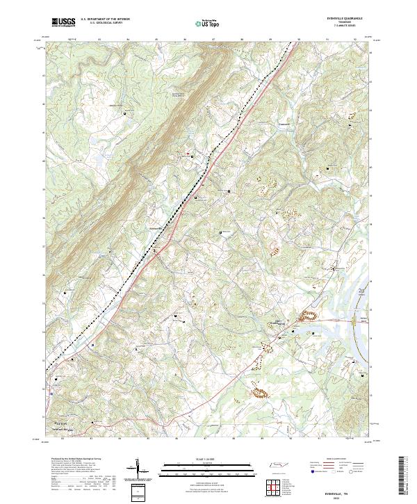
2022 Map of Evensville
USGS Topo · Published 2022About this map
Walden Ridge and the Cumberland Escarpment dominate the western portion of this Tennessee landscape, creating a sharp elevation change that funnels drainage toward the Tennessee River. Between these heights and the river, the valley is populated by long-standing communities like Evensville and Old Washington, where a dense concentration of family and community burial grounds, including Hazelwood Cem, Slave Cem, and Mynatt Cem, provides a map for genealogical research. The transportation corridor is defined by the Norfolk Southern rail line and US Highway 27, which run parallel to the ridge line. Significant topographical features like the Yarborough Gulf and The Shinbone showcase the complex geology of Rhea County, while the eastern border follows the river's path through Hunter Bend and Hazel Ridge Shoals.
Find a feature on this map
157 named features on this map. Tap any name to fly to it.
Don’t see what you’re looking for? This feature index may not catch every label — zoom into the map to look around manually.
Map Details
Editions of this 2022 Evensville Map
This is the sole edition of this map. No revisions or reprints were ever made.
Other maps of this area

1886 · Cleveland
USGS Topo · 1:125,000

1887 · Kingston
USGS Topo · 1:125,000

1888 · Chattanooga
USGS Topo · 1:125,000

1891 · Kingston
USGS Topo · 1:125,000

1892 · Pikeville
USGS Topo · 1:125,000

1892 · Cleveland
USGS Topo · 1:125,000

1893 · Chattanooga
USGS Topo · 1:125,000

1893 · Kingston
USGS Topo · 1:125,000

1895 · Cleveland
USGS Topo · 1:125,000

1895 · Pikeville
USGS Topo · 1:125,000