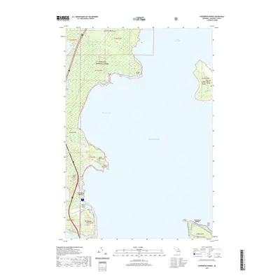
2019 Map of Evergreen Shores
USGS Topo · Published 2019About this map
Evergreen Shores and St. Ignace occupy the rugged shoreline of Lake Huron on the Straits of Mackinac. This northern Michigan landscape is defined by its transition from the densely wooded Hiawatha National Forest to the coastal waters of Horseshoe Bay and Saint Martin Bay. Landmarks like the prominent Castle Rock and Rabbit Back Peak overlook the northern entrance to the straits, while the Mackinac County Airport and a network of roads including North State Street and Grondin Road facilitate movement through this gateway region.
Find a feature on this map
39 named features on this map. Tap any name to fly to it.
Don’t see what you’re looking for? This feature index may not catch every label — zoom into the map to look around manually.
Map Details
Editions of this 2019 Evergreen Shores Map
This is the sole edition of this map. No revisions or reprints were ever made.
Other maps of this area

1931 · St Ignace NW
USGS Topo · 1:31,680

1931 · Moran NE
USGS Topo · 1:31,680

1931 · Ozark SE
USGS Topo · 1:31,680

1932 · St Ignace NE
USGS Topo · 1:31,680

1948 · Moran NE
USGS Topo · 1:31,680

1954 · Sault Sainte Marie
USGS Topo · 1:250,000

1955 · Cheboygan
USGS Topo · 1:250,000

1956 · Sault Sainte Marie
USGS Topo · 1:250,000

1957 · Sault Sainte Marie
USGS Topo · 1:250,000

1958 · Cheboygan
USGS Topo · 1:250,000
Featured Places
- Saint Ignace, MI
- Mackinac Island, MI
- British Landing, Mackinac Island
- Evergreen Shores, MI
- Moran Township, MI