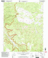
2001 Map of Fable Valley
USGS Topo · Published 2004About this map
The Dark Canyon Wilderness Study Area dominates this section of San Juan County, revealing an intricate landscape of canyons and plateaus as they appeared in the early 21st century. The map highlights the primitive character of the Monticello Ranger District within the Manti-La Sal National Forest. Topographic detail traces the descent from the Dark Canyon Plateau into the winding depths of Gypsum Canyon and Fable Valley. In the northern half, the high desert expanse of Beef Basin is defined by intermittent water sources like Homewater Spring and Stanley Spring, which were vital for cattle and wildlife in this arid environment. Ancient human presence is quietly noted in the naming of Ruin Canyon and Moki Spring, while the physical relief of the Sweet Alice Hills and House Park Butte provides clear landmarks for those navigating this portion of the Colorado Plateau.
Find a feature on this map
57 named features on this map. Tap any name to fly to it.
Don’t see what you’re looking for? This feature index may not catch every label — zoom into the map to look around manually.
Map Details
Editions of this 2001 Fable Valley Map
This is the sole edition of this map. No revisions or reprints were ever made.
Other maps of this area

1885 · San Rafael
USGS Topo · 1:250,000

1885 · La Sal
USGS Topo · 1:250,000

1886 · Henry Mountains
USGS Topo · 1:250,000

1886 · Abajo
USGS Topo · 1:250,000

1892 · Abajo
USGS Topo · 1:250,000

1892 · Henry Mountains
USGS Topo · 1:250,000

1893 · Abajo
USGS Topo · 1:250,000

1935 · Elk Ridge
USGS Topo · 1:96,000

1940 · Elk Ridge
USGS Topo · 1:125,000

1952 · Mouth of Dark Canyon
USGS Topo · 1:62,500