1964 Map of Fairbanks
USGS Topo · Published 1964About this map
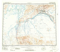
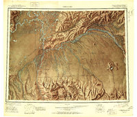
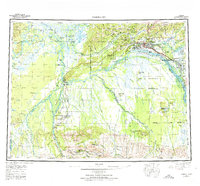
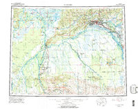
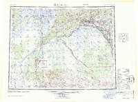
Fairbanks serves as the focal point of this mid-century interior Alaskan landscape, situated at the confluence of the Chena River and the Tanana River. The map illustrates a region defined by its vital transportation and military corridors, with The Alaska Railroad threading through settlements like Dunbar, Standard, and Nenana. The military footprint is significant, featuring Eielson Air Force Base southeast of the city and a vast Bombing and Gunnery Range dominating the central terrain south of the Salchaket Slough.
Find a feature on this map
74 named features on this map. Tap any name to fly to it.
Don’t see what you’re looking for? This feature index may not catch every label — zoom into the map to look around manually.
Map Details
Editions of this 1964 Fairbanks Map
This is the sole edition of this map. No revisions or reprints were ever made.
Historical Maps of Fairbanks Through Time
5 maps found