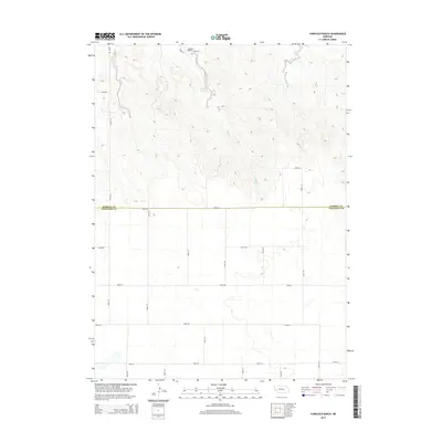
2014 Map of Fairchild Ranch
USGS Topo · Published 2014About this map
Fairchild Ranch sits at the northern edge of this high plains landscape, situated near the headwaters of Cedar Creek. The terrain is defined by a series of north-south drainage patterns and seasonal watercourses, most notably captured by the Fairchild Reservoir. This 2014 survey documents the agricultural and ranching infrastructure along the border of Morrill Co and Cheyenne Co, where a rigid grid of section roads like Road 62 and Road 123 segments the open country. The map illustrates the specialized water management essential for ranching in Western Nebraska, showing the relationship between small reservoirs and the natural creek beds that cross this expansive territory.
Find a feature on this map
20 named features on this map. Tap any name to fly to it.
Don’t see what you’re looking for? This feature index may not catch every label — zoom into the map to look around manually.
Map Details
Editions of this 2014 Fairchild Ranch Map
This is the sole edition of this map. No revisions or reprints were ever made.
Other maps of this area

1896 · Browns Creek
USGS Topo · 1:125,000

1899 · Browns Creek
USGS Topo · 1:125,000

1899 · Sidney
USGS Topo · 1:125,000

1954 · Scottsbluff
USGS Topo · 1:250,000

1958 · Scottsbluff
USGS Topo · 1:250,000

1965 · Broadwater
USGS Topo · 1:24,000

1965 · Broadwater SW
USGS Topo · 1:24,000

1971 · Tar Valley SW
USGS Topo · 1:24,000

1972 · Lisco NW
USGS Topo · 1:24,000

1972 · Gurley
USGS Topo · 1:24,000