
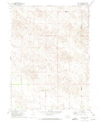
1965 Map of Broadwater
USGS Topo · Published 1967About this map
Broadwater serves as the focal point of this mid-century Nebraska survey, situated along the north bank of the braided North Platte River. The landscape reveals a complex network of water management essential to the region's agricultural life, featuring the Beerline Canal, Belmont Canal, and Radcliff No 3 Canal. These man-made waterways contrast with natural drainages like Browns Creek and Cedar Creek, illustrating the extensive irrigation infrastructure developed in Morrill County.
Find a feature on this map
15 named features on this map. Tap any name to fly to it.
Don’t see what you’re looking for? This feature index may not catch every label — zoom into the map to look around manually.
Map Details
Editions of this 1965 Broadwater Map
This is the sole edition of this map. No revisions or reprints were ever made.
Other maps of this area

1896 · Browns Creek
USGS Topo · 1:125,000

1899 · Browns Creek
USGS Topo · 1:125,000

1899 · Sidney
USGS Topo · 1:125,000

1954 · Scottsbluff
USGS Topo · 1:250,000

1958 · Scottsbluff
USGS Topo · 1:250,000

1965 · Broadwater NW
USGS Topo · 1:24,000

1965 · Broadwater SW
USGS Topo · 1:24,000

1965 · Broadwater NE
USGS Topo · 1:24,000

1971 · Tar Valley SW
USGS Topo · 1:24,000
1971 · Tar Valley
USGS Topo · 1:24,000