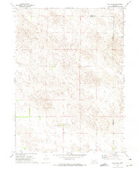
1971 Map of Tar Valley
USGS Topo · Published 1974About this map
Tar Valley defines the landscape of this high-plains Nebraska survey, where the undulating dunes and depressions of the Sandhills are captured in precise topographic detail. The terrain is largely defined by these natural contours, illustrating the specialized land use required in such a porous environment during the early 1970s. Human activity is sparse, centered on the Frizler Fair Haven Ranch, a named landmark that suggests the importance of large-scale cattle ranching and localized family operations in this portion of the Panhandle. Along the eastern border, Horse Lake sits near the county line, providing a rare permanent water feature in an otherwise arid expanse of rangeland. The map clearly delineates the boundary between Garden County and Morrill County, showing how these political lines intersect the natural drainage patterns and private holdings of the era.
Find a feature on this map
5 named features on this map. Tap any name to fly to it.
Don’t see what you’re looking for? This feature index may not catch every label — zoom into the map to look around manually.
Map Details
Editions of this 1971 Tar Valley Map
This is the sole edition of this map. No revisions or reprints were ever made.
Other maps of this area

1896 · Browns Creek
USGS Topo · 1:125,000

1899 · Browns Creek
USGS Topo · 1:125,000

1949 · Lynn
USGS Topo · 1:62,500

1950 · Storm Lake
USGS Topo · 1:62,500

1954 · Scottsbluff
USGS Topo · 1:250,000

1958 · Scottsbluff
USGS Topo · 1:250,000

1965 · Broadwater
USGS Topo · 1:24,000

1965 · Broadwater NE
USGS Topo · 1:24,000

1971 · Richardson Lake
USGS Topo · 1:24,000

1971 · Tar Valley SW
USGS Topo · 1:24,000