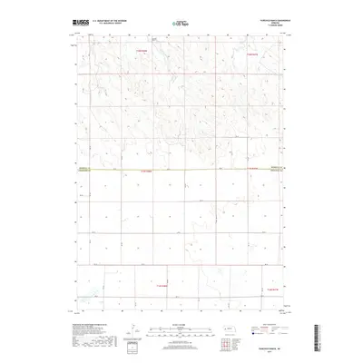
2017 Map of Fairchild Ranch
USGS Topo · Published 2017About this map
Fairchild Ranch sits at the northern edge of this Nebraska landscape, where the high plains of the Panhandle meet the intermittent flow of Cedar Creek. The terrain is defined by a grid of section lines and gravel routes, including RD 62, which marks the boundary between Morrill and Cheyenne Counties. This 2017 survey illustrates the enduring cattle-ranching layout of the region, showing how contemporary land use still follows the foundational Public Land Survey System. The map traces the winding course of Cedar Cr as it carves through the local topography, providing a detailed view of the drainage patterns and relief that dictate the placement of ranch infrastructure and local roads like RD 123 and RD 56.
Find a feature on this map
23 named features on this map. Tap any name to fly to it.
Don’t see what you’re looking for? This feature index may not catch every label — zoom into the map to look around manually.
Map Details
Editions of this 2017 Fairchild Ranch Map
This is the sole edition of this map. No revisions or reprints were ever made.
Other maps of this area

1896 · Browns Creek
USGS Topo · 1:125,000

1899 · Browns Creek
USGS Topo · 1:125,000

1899 · Sidney
USGS Topo · 1:125,000

1954 · Scottsbluff
USGS Topo · 1:250,000

1958 · Scottsbluff
USGS Topo · 1:250,000

1965 · Broadwater
USGS Topo · 1:24,000

1965 · Broadwater SW
USGS Topo · 1:24,000

1971 · Tar Valley SW
USGS Topo · 1:24,000

1972 · Lisco NW
USGS Topo · 1:24,000

1972 · Gurley
USGS Topo · 1:24,000