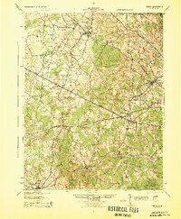
1944 Map of Fairfax
USGS Topo · Published 1944About this map
Washington and Old Dominion RR and the Southern RR anchor the transport network of Northern Virginia during the mid-1940s, revealing a landscape of rural crossroads and growing towns before modern suburbanization. The transit-oriented development of the era is evident in settlements like Herndon and Vienna, while the interior remains a patchwork of small communities and rural services such as the Oak Grove Store and Bear School.
Find a feature on this map
84 named features on this map. Tap any name to fly to it.
Don’t see what you’re looking for? This feature index may not catch every label — zoom into the map to look around manually.
Map Details
Editions of this 1944 Fairfax Map
This is the sole edition of this map. No revisions or reprints were ever made.
Other maps of this area

1884 · Harpers Ferry
USGS Topo · 1:125,000

1890 · Mt. Vernon
USGS Topo · 1:125,000

1891 · Harpers Ferry
USGS Topo · 1:125,000

1891 · Mt. Vernon
USGS Topo · 1:125,000

1893 · Frederick
USGS Topo · 1:125,000

1893 · Harpers Ferry
USGS Topo · 1:125,000

1894 · Warrenton
USGS Topo · 1:125,000

1894 · Frederick
USGS Topo · 1:125,000

1894 · Mt. Vernon
USGS Topo · 1:125,000

1897 · Mt. Vernon
USGS Topo · 1:125,000