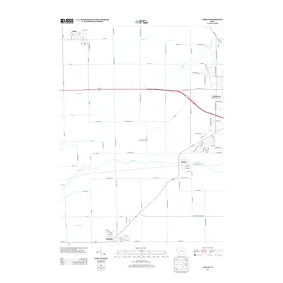
2013 Map of Fairfax
USGS Topo · Published 2013About this map
Fairfax and Walford anchor this 2013 survey of the Cedar Rapids outskirts, illustrating the persistent agricultural grid intersecting with modern residential expansion. The landscape is defined by the winding course of Prairie Cr, which flows eastward toward the more developed fringes of Hometown-Cedar Terrace. While the northern section around Atkins maintains its classic small-town structure, the central portion of the map shows a more complex web of infrastructure, including the intersections of 80th St NW and Covington Rd. The presence of numerous creeks like Morgan Cr and Silver Cr creates a natural drainage network that has dictated the placement of roads and farmsteads for generations. This map provides a clear record of the transition from rural Linn County heritage to suburban integration as the regional population moved outward from the urban center.
Find a feature on this map
104 named features on this map. Tap any name to fly to it.
Don’t see what you’re looking for? This feature index may not catch every label — zoom into the map to look around manually.
Map Details
Editions of this 2013 Fairfax Map
This is the sole edition of this map. No revisions or reprints were ever made.
Other maps of this area

1887 · Cedar Rapids
USGS Topo · 1:62,500

1888 · Shellsburg
USGS Topo · 1:62,500

1888 · Marion
USGS Topo · 1:62,500

1888 · Amana
USGS Topo · 1:62,500

1889 · Marion
USGS Topo · 1:62,500

1889 · Amana
USGS Topo · 1:62,500

1889 · Shellsburg
USGS Topo · 1:62,500

1891 · Cedar Rapids
USGS Topo · 1:62,500

1899 · Amana
USGS Topo · 1:62,500

1899 · Shellsburg
USGS Topo · 1:62,500