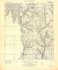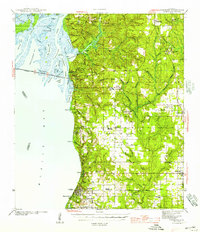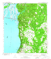
1941 Map of Fairhope
USGS Topo · Published 1965About this map
Fairhope and the eastern shore of Mobile Bay are documented here during the early 1940s, showing a landscape defined by small coastal settlements and a complex network of bayous and rivers. The presence of Civil War Trenches and the historic Spanish Fort site provides clear evidence of the area's strategic military importance in previous generations. Further inland, the map records rural hubs like Loxley and Silverhill, the latter featuring the Bohemian Hall, reflecting the diverse cultural heritage of Baldwin County's settlers.
Find a feature on this map
95 named features on this map. Tap any name to fly to it.
Don’t see what you’re looking for? This feature index may not catch every label — zoom into the map to look around manually.
Map Details
Editions of this 1941 Fairhope Map
This is the sole edition of this map. No revisions or reprints were ever made.
Historical Maps of Mobile Through Time
4 maps found