2022 Map of Fairmount
USGS Topo · Published 2022About this map
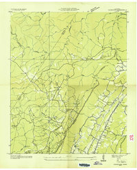
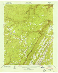
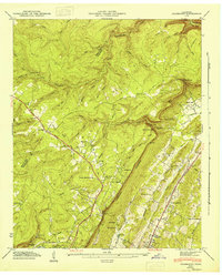
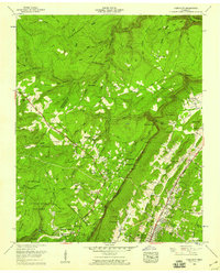
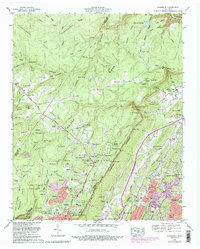
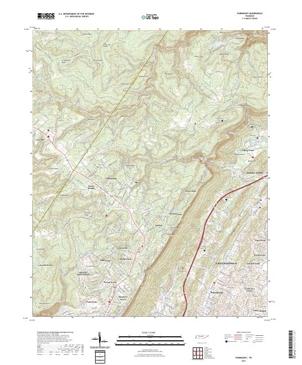
Walden Ridge and the sharp drop of the Cumberland Escarpment define the geography of this area north of Chattanooga and Red Bank. The landscape is a mix of high plateau settlements like Lone Oak, Fairmount, and Signal Mountain, and the deeply incised gorges of the Pickett Gulf and Falling Water Cr. These drainages create dramatic features including Falling Water Falls, Frydenlund Falls, and Slider Falls. Local history is preserved in numerous family and community burial grounds, such as Sawyer Cem, Vandergriff Cem, and Fairmount Cem. The survey illustrates the transition from the relatively level terrain of Timesville and Applewood to the complex ridges and hollows like Chicken Hollow and The Horseshoe, where the Sequatchie and Hamilton county line follows the high ground.
Find a feature on this map
290 named features on this map. Tap any name to fly to it.
Don’t see what you’re looking for? This feature index may not catch every label — zoom into the map to look around manually.
Map Details
Editions of this 2022 Fairmount Map
This is the sole edition of this map. No revisions or reprints were ever made.
Historical Maps of Fairmount Through Time
6 maps found