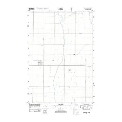
2011 Map of Fairmount
USGS Topo · Published 2011About this map
Fairmount serves as the primary hub of this Red River Valley landscape, where the grid of agricultural roads meets the winding path of the Bois de Sioux River. The town's layout is clearly defined by its residential blocks and central Main Ave, while the surrounding prairie is dotted with localized landmarks such as the Wetherbee Farm Airport. Genealogists and local historians can find several dedicated burial sites across the township, including Calvary Cemetery north of the main settlement and Fairmount Cemetery to the southwest. The confluence of the Rabbit River and the Bois de Sioux River in the north illustrates the natural drainage patterns of this border region. To the east, the small settlement of Childs sits along the township line, connected by a network of rural routes like Twp Hwy 117 and County Hwy-9.
Find a feature on this map
43 named features on this map. Tap any name to fly to it.
Don’t see what you’re looking for? This feature index may not catch every label — zoom into the map to look around manually.
Map Details
Editions of this 2011 Fairmount Map
This is the sole edition of this map. No revisions or reprints were ever made.
Other maps of this area

1904 · Wahpeton
USGS Topo · 1:125,000

1915 · White Rock
USGS Topo · 1:62,500

1918 · White Rock
USGS Topo · 1:62,500

1951 · Wheaton
USGS Topo · 1:62,500

1951 · Campbell
USGS Topo · 1:62,500

1953 · Milbank
USGS Topo · 1:250,000

1953 · Fargo
USGS Topo · 1:250,000

1956 · Fargo
USGS Topo · 1:250,000

1958 · Milbank
USGS Topo · 1:250,000

1964 · Fairmount NW
USGS Topo · 1:24,000