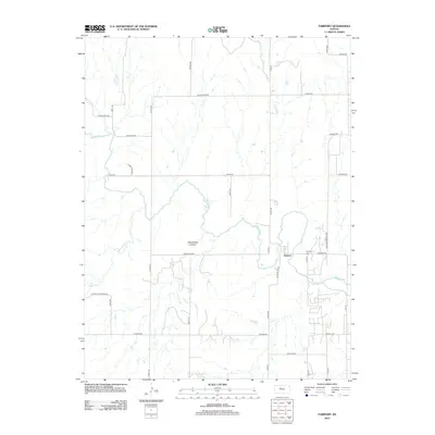
2012 Map of Fairport
USGS Topo · Published 2012About this map
The settlement of Fairport serves as the focal point for this rural Kansas landscape, situated near the meandering path of the Saline River. The terrain is defined by the significant drainage of Sweetwater Cr, which has carved out the prominent Sweetwater Canyon to the west of the town. This 2012 survey illustrates a region where the grid of sectional roads, such as Homestead Rd and Severin Rd, navigates the natural breaks of the river valley. Local history is anchored at the Fairport Cem, while the road network, including the Ellis Co Line Rd and St John-St Andrew Rd, reveals the connectivity between isolated farmsteads and neighboring communities. The map provides a detailed view of the rural infrastructure and land use patterns that define this portion of Russell County.
Find a feature on this map
31 named features on this map. Tap any name to fly to it.
Don’t see what you’re looking for? This feature index may not catch every label — zoom into the map to look around manually.
Map Details
Editions of this 2012 Fairport Map
This is the sole edition of this map. No revisions or reprints were ever made.
Other maps of this area

1896 · Osborne
USGS Topo · 1:125,000

1896 · Russell
USGS Topo · 1:125,000

1896 · Hays
USGS Topo · 1:125,000

1896 · Plainville
USGS Topo · 1:125,000

1955 · Great Bend
USGS Topo · 1:250,000

1955 · Beloit
USGS Topo · 1:250,000

1957 · Great Bend
USGS Topo · 1:250,000

1958 · Great Bend
USGS Topo · 1:250,000

1959 · Beloit
USGS Topo · 1:250,000

1961 · Catharine
USGS Topo · 1:24,000