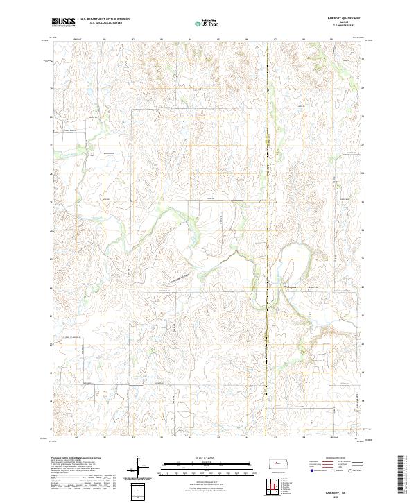
2022 Map of Fairport
USGS Topo · Published 2022About this map
Fairport sits at the intersection of the Saline River and a network of county roads along the border of Ellis and Russell counties. This agricultural landscape is defined by the winding course of the river and the carved depths of Sweetwater Canyon to the west. The map shows a classic Section-Range-Township grid system that organizes the rural holdings of northern Kansas, with section lines marked by routes like Waldo Rd and Paradise Rd. Cultural landmarks are sparse but significant for local history, notably the Fairport Cem located just east of the main settlement. The terrain transitions from flat upland plains into the breaks of the river valley, where Sweetwater Cr drains into the larger river system. This survey provides a clear view of the modern infrastructure and drainage patterns that have shaped this prairie community.
Find a feature on this map
32 named features on this map. Tap any name to fly to it.
Don’t see what you’re looking for? This feature index may not catch every label — zoom into the map to look around manually.
Map Details
Editions of this 2022 Fairport Map
This is the sole edition of this map. No revisions or reprints were ever made.
Other maps of this area

1896 · Osborne
USGS Topo · 1:125,000

1896 · Russell
USGS Topo · 1:125,000

1896 · Hays
USGS Topo · 1:125,000

1896 · Plainville
USGS Topo · 1:125,000

1955 · Great Bend
USGS Topo · 1:250,000

1955 · Beloit
USGS Topo · 1:250,000

1957 · Great Bend
USGS Topo · 1:250,000

1958 · Great Bend
USGS Topo · 1:250,000

1959 · Beloit
USGS Topo · 1:250,000

1961 · Catharine
USGS Topo · 1:24,000