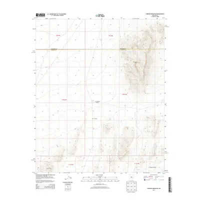
2013 Map of Fairview Mountain
USGS Topo · Published 2013About this map
Fairview Mtn dominates the eastern landscape of this high desert region in New Mexico, situated along the county line shared by Socorro and Sierra counties. The terrain is characterized by the expansive arid flats of the Jornada del Muerto, a basin historically known for its challenging passage. This 2013 survey illustrates a landscape primarily defined by its drainage patterns and water management, with features like Jonce Canyon and Thurgood Canyon carving through the elevation. Isolated water sources such as Martin Tank, Ladder Tank, and the McDonald Brother Tank reflect the ranching infrastructure necessary for survival in the Poison Hills area. The map provides a detailed view of the Public Land Survey System divisions, including t10s r4e and t11s r4e, showing how this vast territory was partitioned for management.
Find a feature on this map
15 named features on this map. Tap any name to fly to it.
Don’t see what you’re looking for? This feature index may not catch every label — zoom into the map to look around manually.
Map Details
Editions of this 2013 Fairview Mountain Map
This is the sole edition of this map. No revisions or reprints were ever made.
Other maps of this area

1916 · Salinas Peak
USGS Topo · 1:125,000

1916 · Tularosa
USGS Topo · 1:125,000

1918 · Oscura Peak
USGS Topo · 1:125,000

1947 · Capitol Peak
USGS Topo · 1:62,500

1948 · Granjean Well
USGS Topo · 1:62,500

1948 · Mockingbird Gap
USGS Topo · 1:62,500

1948 · Salinas Peak
USGS Topo · 1:62,500

1954 · Tularosa
USGS Topo · 1:250,000

1958 · Tularosa
USGS Topo · 1:250,000

1981 · Big Gyp Mountain
USGS Topo · 1:24,000