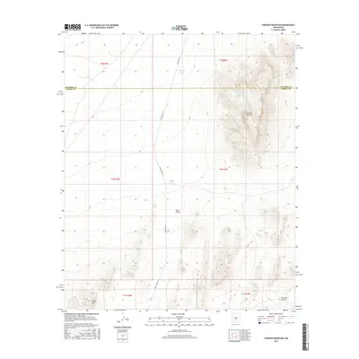
2017 Map of Fairview Mountain
USGS Topo · Published 2017About this map
Fairview Mountain rises prominently along the high desert border between Socorro and Sierra counties in this 2017 survey. The landscape is defined by its arid character and reliance on specialized water infrastructure, evidenced by livestock or wildlife watering points such as Martin Tank, Ladder Tank, and McDonald Brother Tank. These man-made features are vital anchors in an environment carved by seasonal drainages like Jonce Canyon and Thurgood Canyon. To the southwest, the Poison Hills add topographic complexity to the basin and range terrain. The presence of WSMR P Route 13 indicates the area's integration with the White Sands Missile Range infrastructure, marking a intersection of traditional ranching geography and modern federal land use.
Find a feature on this map
15 named features on this map. Tap any name to fly to it.
Don’t see what you’re looking for? This feature index may not catch every label — zoom into the map to look around manually.
Map Details
Editions of this 2017 Fairview Mountain Map
This is the sole edition of this map. No revisions or reprints were ever made.
Other maps of this area

1916 · Salinas Peak
USGS Topo · 1:125,000

1916 · Tularosa
USGS Topo · 1:125,000

1918 · Oscura Peak
USGS Topo · 1:125,000

1947 · Capitol Peak
USGS Topo · 1:62,500

1948 · Granjean Well
USGS Topo · 1:62,500

1948 · Mockingbird Gap
USGS Topo · 1:62,500

1948 · Salinas Peak
USGS Topo · 1:62,500

1954 · Tularosa
USGS Topo · 1:250,000

1958 · Tularosa
USGS Topo · 1:250,000

1981 · Big Gyp Mountain
USGS Topo · 1:24,000