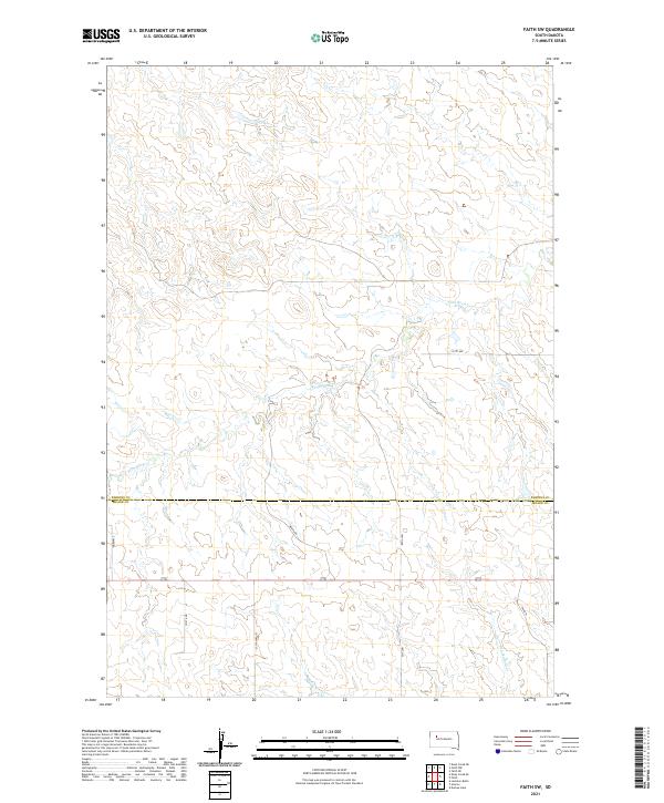
2021 Map of Faith SW
USGS Topo · Published 2021About this map
Flint Rock Creek carves a winding path through the expansive prairie landscape of this modern 2021 survey, which straddles the Perkins Co Meade Co boundary in western South Dakota. The topography is defined by the drainage basins of Flint Rock Creek and Red Scaffold Creek, showing a terrain where water dictates the subtle contours of the land. The human footprint remains sparse, represented largely by a grid of rural section lines and access roads like Co Hwy MC-37 and Wagon Rd. These corridors reflect the persistent ranching and agricultural patterns of the region, where wide-open spaces are managed through a network of numbered avenues and local routes. This map provides a clear picture of the contemporary spatial organization in a region where natural watercourses and county administrative lines remain the primary landmarks for local navigation.
Find a feature on this map
15 named features on this map. Tap any name to fly to it.
Don’t see what you’re looking for? This feature index may not catch every label — zoom into the map to look around manually.
Map Details
Editions of this 2021 Faith SW Map
This is the sole edition of this map. No revisions or reprints were ever made.
Other maps of this area

1951 · Faith NE
USGS Topo · 1:24,000

1952 · Deep Creek SE
USGS Topo · 1:24,000

1952 · Deep Creek NE
USGS Topo · 1:24,000

1952 · Faith NW
USGS Topo · 1:24,000

1953 · Rapid City
USGS Topo · 1:250,000

1954 · Lemmon
USGS Topo · 1:250,000

1957 · Lemmon
USGS Topo · 1:250,000

1957 · Rapid City
USGS Topo · 1:250,000
1983 · Faith
USGS Topo · 1:24,000

1983 · Lemmon Butte
USGS Topo · 1:24,000