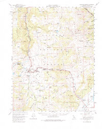
1956 Map of Fales Hot Springs
USGS Topo · Published 1984About this map
Fales Hot Springs serves as a central landmark in this high-altitude landscape of the Toiyabe National Forest during the mid-1950s. The region is defined by a network of creeks and canyons supporting a history of mining and ranching, evidenced by the Deep Creek Mine, the Angelo Mission Mine, and the Frederick Mine near Belfort. Transportation through the mountains is anchored at Sonora Junction and Hardy Station, while seasonal agriculture is reflected in sites like the Little Walker Cowcamp and Sario Ranch.
Find a feature on this map
108 named features on this map. Tap any name to fly to it.
Don’t see what you’re looking for? This feature index may not catch every label — zoom into the map to look around manually.
Map Details
Editions of this 1956 Fales Hot Springs Map
5 editions found

Other maps of this area

1889 · Markleeville
USGS Topo · 1:125,000

1891 · Markleeville
USGS Topo · 1:125,000

1891 · Wellington
USGS Topo · 1:125,000

1893 · Markleeville
USGS Topo · 1:125,000

1893 · Wellington
USGS Topo · 1:125,000

1896 · Dardanelles
USGS Topo · 1:125,000

1898 · Dardanelles
USGS Topo · 1:125,000

1909 · Bridgeport
USGS Topo · 1:125,000

1911 · Bridgeport
USGS Topo · 1:125,000

1920 · Bridgeport
USGS Topo · 1:125,000