
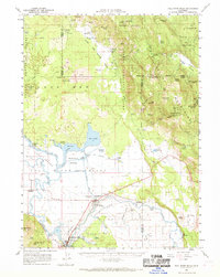
1961 Map of Fall River Mills
USGS Topo · Published 1963About this map
Fall River meanders through a complex valley landscape of volcanic formations and marshy lowlands in this early 1960s study of northeast California. The convergence of the Fall River and the Pit River at Fall River Mills anchors a region defined by extensive water management, visible through the McArthur Diversion Canal and the Lee Drainage Canal. These engineering works transformed the McArthur Swamp and surrounding areas, supporting agricultural settlements like McArthur and Pittville.
Find a feature on this map
78 named features on this map. Tap any name to fly to it.
Don’t see what you’re looking for? This feature index may not catch every label — zoom into the map to look around manually.
Map Details
Editions of this 1961 Fall River Mills Map
2 editions found
Other maps of this area

1886 · Lassen Peak
USGS Topo · 1:250,000

1886 · Modoc Lava Bed
USGS Topo · 1:250,000

1892 · Modoc Lava-Bed
USGS Topo · 1:250,000

1892 · Lassen Peak
USGS Topo · 1:250,000

1894 · Lassen Peak
USGS Topo · 1:250,000

1932 · Bartle
USGS Topo · 1:96,000

1935 · Burney
USGS Topo · 1:96,000

1939 · Burney
USGS Topo · 1:125,000

1939 · Halls Flat
USGS Topo · 1:125,000

1939 · Bartle
USGS Topo · 1:125,000