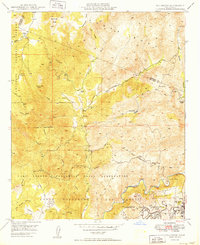
1949 Map of Fallbrook
USGS Topo · Published 1949About this map
The town of Fallbrook anchors the southeastern corner of this 1940s landscape, which is largely dominated by extensive military holdings and private ranching interests. Significant portions of the territory are designated as the Camp Joseph H Pendleton Naval Reservation and the Fallbrook Naval Reservation, reflecting the region's mid-century importance for defense operations, including a marked Target Range. Beyond the military boundaries, the map traces the deep-cut Sandia Canyon and the winding course of the Santa Margarita River. Small rural schoolhouse life is preserved in the label for De Luz Sch, while numerous private holdings such as Sky Ranch, Johnson Ranch, and Garnsay Ranch illustrate the agricultural and pastoral footprint of Northern San Diego County before later suburban developments took hold. The northern reaches are characterized by steep topography like Redonda Mesa and the fringes of the Cleveland National Forest.
Find a feature on this map
32 named features on this map. Tap any name to fly to it.
Don’t see what you’re looking for? This feature index may not catch every label — zoom into the map to look around manually.
Map Details
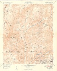
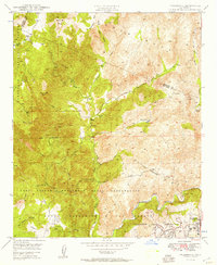
Editions of this 1949 Fallbrook Map
3 editions found
Other maps of this area

1901 · Southern California Sheet No. 1
USGS Topo · 1:250,000

1901 · Elsinore
USGS Topo · 1:125,000

1901 · San Luis Rey
USGS Topo · 1:125,000

1904 · Southern California Sheet No. 2
USGS Topo · 1:250,000

1904 · Southern California Sheet No. 1
USGS Topo · 1:250,000

1941 · Margarita Peak
USGS Topo · 1:62,500

1942 · Lake Elsinore
USGS Topo · 1:62,500

1942 · Margarita Peak
USGS Topo · 1:62,500

1942 · Temecula
USGS Topo · 1:62,500

1942 · Murrieta
USGS Topo · 1:62,500
Featured Places
- Fallbrook, CA
- Marine Corps Base Camp Pendleton, CA
- Santa Margarita Groves, CA
- De Luz Heights, CA
- De Luz, CA