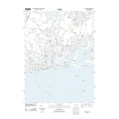
2012 Map of Falmouth
USGS Topo · Published 2012About this map
Waquoit Village and the surrounding coastal communities of Acapesket and Falmouth Heights define the residential and maritime character of this 2012 survey. The landscape is a complex network of freshwater kettle ponds, such as Coonamessett Pond and Jenkins Pond, alongside the saltwater inlets of Great Pond and Green Pond. These water bodies are separated by narrow necks of land like Bournes Neck and Lawrence Neck, illustrating the classic glacial geology of the Cape.
Find a feature on this map
90 named features on this map. Tap any name to fly to it.
Don’t see what you’re looking for? This feature index may not catch every label — zoom into the map to look around manually.
Map Details
Editions of this 2012 Falmouth Map
This is the sole edition of this map. No revisions or reprints were ever made.
Other maps of this area

1886 · Falmouth
USGS Topo · 1:62,500

1887 · Marthas Vineyard
USGS Topo · 1:62,500

1888 · Barnstable
USGS Topo · 1:62,500

1888 · Falmouth
USGS Topo · 1:62,500

1889 · Marthas Vineyard
USGS Topo · 1:62,500

1893 · Barnstable
USGS Topo · 1:62,500

1893 · Falmouth
USGS Topo · 1:62,500

1894 · Marthas Vineyard
USGS Topo · 1:62,500

1915 · Falmouth
USGS Topo · 1:62,500

1920 · Falmouth
USGS Topo · 1:62,500