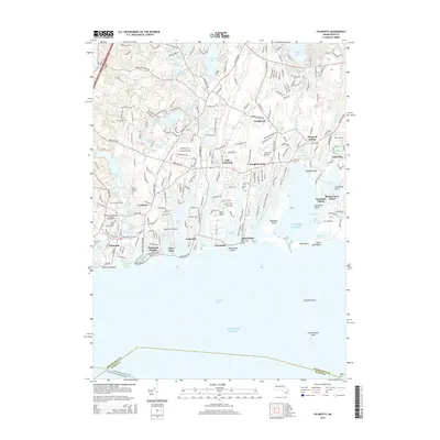
2015 Map of Falmouth
USGS Topo · Published 2015About this map
Falmouth and its surrounding coastal villages are defined by a complex network of glacial ponds and tidal inlets along the Vineyard Sound. This modern topographic survey reveals the dense residential patterns of settlements like East Falmouth, Teaticket, and Waquoit Village. The landscape is etched with the heritage of early families and community life, preserved in sites like the Methodist Cem, Saint Patricks Cem, and the historic Old Town Cem. Inland, the Coonamessett River and Childs River drain toward the Atlantic, while coastal features such as Washburn Island and Davis Neck illustrate the fragile transition between land and sea. Infrastructure like the Falmouth Airpark and the National Graduate Sch of Quality Management sit alongside older maritime landmarks like Falmouth Harbor and Menauhant Beach, showing the continued evolution of this Cape Cod shoreline.
Find a feature on this map
106 named features on this map. Tap any name to fly to it.
Don’t see what you’re looking for? This feature index may not catch every label — zoom into the map to look around manually.
Map Details
Editions of this 2015 Falmouth Map
This is the sole edition of this map. No revisions or reprints were ever made.
Other maps of this area

1886 · Falmouth
USGS Topo · 1:62,500

1887 · Marthas Vineyard
USGS Topo · 1:62,500

1888 · Barnstable
USGS Topo · 1:62,500

1888 · Falmouth
USGS Topo · 1:62,500

1889 · Marthas Vineyard
USGS Topo · 1:62,500

1893 · Barnstable
USGS Topo · 1:62,500

1893 · Falmouth
USGS Topo · 1:62,500

1894 · Marthas Vineyard
USGS Topo · 1:62,500

1915 · Falmouth
USGS Topo · 1:62,500

1920 · Falmouth
USGS Topo · 1:62,500