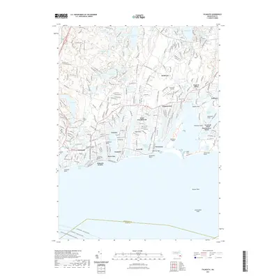
2021 Map of Falmouth
USGS Topo · Published 2021About this map
Falmouth and its surrounding coastal villages are defined by a complex network of freshwater ponds and saltwater inlets on the southwestern shoulder of Cape Cod. The landscape transitions from the dense settlement of the town center and Falmouth Heights to the scattered residential clusters of Teaticket and Waquoit Village. Numerous glacial kettle ponds, including Coonamessett Pond, Johns Pond, and Long Pond, dot the interior, while the shoreline is carved into distinct points and necks such as Meadow Neck and Bournes Neck. Modern recreation and transit patterns are visible through the Falmouth Shining Sea Trl and the active ferry routes, including the Martha's Vineyard and Woods Hole Ferry, which navigate the waters above Bardow Shoal and L'Hommedieu Shoal. Local heritage is anchored by established sites like the Methodist Society Burying Ground and Oak Grove Cem.
Find a feature on this map
81 named features on this map. Tap any name to fly to it.
Don’t see what you’re looking for? This feature index may not catch every label — zoom into the map to look around manually.
Map Details
Editions of this 2021 Falmouth Map
This is the sole edition of this map. No revisions or reprints were ever made.
Other maps of this area

1886 · Falmouth
USGS Topo · 1:62,500

1887 · Marthas Vineyard
USGS Topo · 1:62,500

1888 · Barnstable
USGS Topo · 1:62,500

1888 · Falmouth
USGS Topo · 1:62,500

1889 · Marthas Vineyard
USGS Topo · 1:62,500

1893 · Barnstable
USGS Topo · 1:62,500

1893 · Falmouth
USGS Topo · 1:62,500

1894 · Marthas Vineyard
USGS Topo · 1:62,500

1915 · Falmouth
USGS Topo · 1:62,500

1920 · Falmouth
USGS Topo · 1:62,500