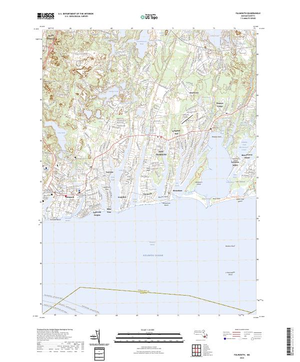
2024 Map of Falmouth
USGS Topo · Published 2024About this map
The coastal settlements of Falmouth and North Falmouth anchor this detailed study of the upper Cape Cod shoreline, where the landscape is defined by glacial kettle ponds and intricate saltwater inlets. Notable for genealogists, the map identifies several historic interment sites, including the Falmouth Old Burying Ground and the Methodist Society Burying Ground near the town center. The eastern portion of the quadrangle is largely occupied by the Mashpee National Wildlife Refuge, preserving the watersheds of the Quashnet River and Childs River. Coastal features like Washburn Island and Dead Neck protect the waters of Waquoit Bay, while aviation activity is marked at the Falmouth Airpark. This modern survey traces the evolution of residential patterns in neighborhoods like Teaticket, Acapesket, and Waquoit Village, illustrating how modern infrastructure follows the ancient contours of the Cape's southern coast.
Find a feature on this map
79 named features on this map. Tap any name to fly to it.
Don’t see what you’re looking for? This feature index may not catch every label — zoom into the map to look around manually.
Map Details
Editions of this 2024 Falmouth Map
This is the sole edition of this map. No revisions or reprints were ever made.
Other maps of this area

1886 · Falmouth
USGS Topo · 1:62,500

1887 · Marthas Vineyard
USGS Topo · 1:62,500

1888 · Barnstable
USGS Topo · 1:62,500

1888 · Falmouth
USGS Topo · 1:62,500

1889 · Marthas Vineyard
USGS Topo · 1:62,500

1893 · Barnstable
USGS Topo · 1:62,500

1893 · Falmouth
USGS Topo · 1:62,500

1894 · Marthas Vineyard
USGS Topo · 1:62,500

1915 · Falmouth
USGS Topo · 1:62,500

1920 · Falmouth
USGS Topo · 1:62,500