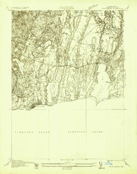
1936 Map of Falmouth
USGS Topo · Published 1936About this map
Waquoit Bay and the interconnected salt ponds of the Cape Cod coastline dominate this 1936 survey, showing the intricate relationship between land and water before mid-century development. The village of Falmouth serves as the western anchor, with the Harbor Lighthouse marking the entrance to Falmouth Inner Harbor. This era of the landscape features a distinct series of north-south glacial finger ponds and coastal inlets including Green Pond, Bowens Pond, and Eel Pond. Inland, the settlement pattern follows historic tracks such as Brick Kiln Road and Blacksmith Shop Road, connecting established clusters like Teaticket and East Falmouth. The coastline remains characterized by natural barriers like Dead Neck and Great Neck, protecting the waters of Nantucket Sound.
Find a feature on this map
53 named features on this map. Tap any name to fly to it.
Don’t see what you’re looking for? This feature index may not catch every label — zoom into the map to look around manually.
Map Details
Editions of this 1936 Falmouth Map
This is the sole edition of this map. No revisions or reprints were ever made.
Other maps of this area

1886 · Falmouth
USGS Topo · 1:62,500

1887 · Marthas Vineyard
USGS Topo · 1:62,500

1888 · Barnstable
USGS Topo · 1:62,500

1888 · Falmouth
USGS Topo · 1:62,500

1889 · Marthas Vineyard
USGS Topo · 1:62,500

1893 · Barnstable
USGS Topo · 1:62,500

1893 · Falmouth
USGS Topo · 1:62,500

1894 · Marthas Vineyard
USGS Topo · 1:62,500

1915 · Falmouth
USGS Topo · 1:62,500

1920 · Falmouth
USGS Topo · 1:62,500