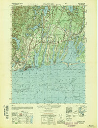
1948 Map of Falmouth
USGS Topo · Published 1949About this map
Cape Cod coastal life and interior pond ecosystems are preserved here in detail just after World War II. The landscape is defined by the long, slender fingers of Great Pond, Green Pond, and Eel Pond, which stretch inland from the Vineyard Sound and Nantucket Sound. Small residential clusters like Acapesket, Davisville, and Menauhant occupy the peninsulas between these waters, while the more established hub of Falmouth serves as the western anchor.
Find a feature on this map
58 named features on this map. Tap any name to fly to it.
Don’t see what you’re looking for? This feature index may not catch every label — zoom into the map to look around manually.
Map Details
Editions of this 1948 Falmouth Map
This is the sole edition of this map. No revisions or reprints were ever made.
Other maps of this area

1886 · Falmouth
USGS Topo · 1:62,500

1887 · Marthas Vineyard
USGS Topo · 1:62,500

1888 · Barnstable
USGS Topo · 1:62,500

1888 · Falmouth
USGS Topo · 1:62,500

1889 · Marthas Vineyard
USGS Topo · 1:62,500

1893 · Barnstable
USGS Topo · 1:62,500

1893 · Falmouth
USGS Topo · 1:62,500

1894 · Marthas Vineyard
USGS Topo · 1:62,500

1915 · Falmouth
USGS Topo · 1:62,500

1920 · Falmouth
USGS Topo · 1:62,500