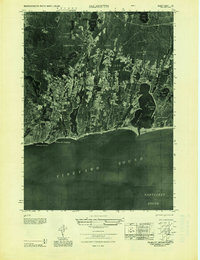
1949 Map of Falmouth
USGS Topo · Published 1949About this map
Waquoit Bay and the salt-water inlets of the southern Cape Cod coast define this 1947 aerial photographic mosaic. The landscape is a detailed study in mid-century coastal development, showing the established grid of Falmouth alongside seasonal residential pockets like Falmouth Heights, Mara Vista, and Acapesket. The interior is dominated by a complex network of glacial kettle ponds, including Coonamessett Pond and Johns Pond, which are surrounded by numerous Cranberry Bogs, a signature of the local agricultural economy at the time.
Find a feature on this map
79 named features on this map. Tap any name to fly to it.
Don’t see what you’re looking for? This feature index may not catch every label — zoom into the map to look around manually.
Map Details
Editions of this 1949 Falmouth Map
This is the sole edition of this map. No revisions or reprints were ever made.
Other maps of this area

1886 · Falmouth
USGS Topo · 1:62,500

1887 · Marthas Vineyard
USGS Topo · 1:62,500

1888 · Barnstable
USGS Topo · 1:62,500

1888 · Falmouth
USGS Topo · 1:62,500

1889 · Marthas Vineyard
USGS Topo · 1:62,500

1893 · Barnstable
USGS Topo · 1:62,500

1893 · Falmouth
USGS Topo · 1:62,500

1894 · Marthas Vineyard
USGS Topo · 1:62,500

1915 · Falmouth
USGS Topo · 1:62,500

1920 · Falmouth
USGS Topo · 1:62,500