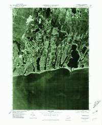
1977 Map of Falmouth
USGS Topo · Published 1981About this map
Cape Cod coastal development and the intricate finger-like inlets of the southern shore define this 1977 orthophotograph. Centered on the town of Falmouth, the imagery captures a specific moment of mid-century residential expansion as neighborhoods branched out through Teaticket and Acapesket. The aerial perspective reveals the dense woodland surrounding Jenkins Pond and the contrasting grid-like patterns of Smalltown near Waquoit Village. By using photographic imagery rather than traditional line-drawn contours, this survey provides a unique view of land use and vegetation density during the late seventies, showing the transition from inland forests to the maritime settlements of East Falmouth along the edge of Vineyard Sound. This visual record serves as a bridge for local historians to see the literal footprint of the community before later modern infill.
Find a feature on this map
10 named features on this map. Tap any name to fly to it.
Don’t see what you’re looking for? This feature index may not catch every label — zoom into the map to look around manually.
Map Details
Editions of this 1977 Falmouth Map
This is the sole edition of this map. No revisions or reprints were ever made.
Other maps of this area

1886 · Falmouth
USGS Topo · 1:62,500

1887 · Marthas Vineyard
USGS Topo · 1:62,500

1888 · Barnstable
USGS Topo · 1:62,500

1888 · Falmouth
USGS Topo · 1:62,500

1889 · Marthas Vineyard
USGS Topo · 1:62,500

1893 · Barnstable
USGS Topo · 1:62,500

1893 · Falmouth
USGS Topo · 1:62,500

1894 · Marthas Vineyard
USGS Topo · 1:62,500

1915 · Falmouth
USGS Topo · 1:62,500

1920 · Falmouth
USGS Topo · 1:62,500