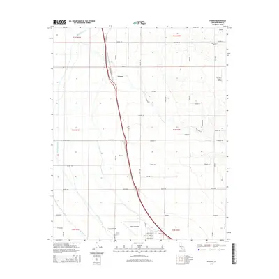
2015 Map of Famoso
USGS Topo · Published 2015About this map
Agricultural infrastructure and water management systems define this section of the San Joaquin Valley north of Shafter. The landscape is dominated by a grid of orchards and fields sustained by a complex network of man-made waterways, including the Friant-Kern Canal, Lerdo Canal, and Calloway Canal. These vital arteries cross the terrain alongside the natural course of Poso Creek. Settlement patterns are concentrated near major transportation and aviation corridors, with the communities of Famoso and Slater situated along the primary north-south transit line. To the south, the aviation history of Kern County is evident at Shafter-Minter Field, which anchors the residential areas of Minter Village and Dow. The map illustrates the 21st-century evolution of the Central Valley's industrial farming and its dependence on precise water distribution and large-scale logistics.
Find a feature on this map
48 named features on this map. Tap any name to fly to it.
Don’t see what you’re looking for? This feature index may not catch every label — zoom into the map to look around manually.
Map Details
Editions of this 2015 Famoso Map
This is the sole edition of this map. No revisions or reprints were ever made.
Other maps of this area

1906 · Bakersfield
USGS Topo · 1:62,500

1910 · Buena Vista Lake
USGS Topo · 1:125,000

1912 · Buena Vista Lake
USGS Topo · 1:125,000

1927 · McFarland
USGS Topo · 1:31,680

1930 · McFarland
USGS Topo · 1:31,680

1930 · Wasco
USGS Topo · 1:31,680

1930 · Pond
USGS Topo · 1:31,680

1930 · Famoso
USGS Topo · 1:31,680

1930 · Rosedale
USGS Topo · 1:31,680

1930 · Oildale
USGS Topo · 1:31,680