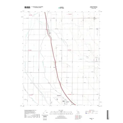
2018 Map of Famoso
USGS Topo · Published 2018About this map
The agricultural and aviation landscape of the Central Valley is clearly defined in this 2018 survey of Kern County. Centered on the intensive irrigation networks of the San Joaquin Valley, the map details a sophisticated water management system including the Friant-Kern Canal, Lerdo Canal, and Calloway Canal. These lifelines support the surrounding farmsteads and small transit-oriented settlements such as Famoso, Slater, and Cawelo.
Find a feature on this map
55 named features on this map. Tap any name to fly to it.
Don’t see what you’re looking for? This feature index may not catch every label — zoom into the map to look around manually.
Map Details
Editions of this 2018 Famoso Map
This is the sole edition of this map. No revisions or reprints were ever made.
Other maps of this area

1906 · Bakersfield
USGS Topo · 1:62,500

1910 · Buena Vista Lake
USGS Topo · 1:125,000

1912 · Buena Vista Lake
USGS Topo · 1:125,000

1927 · McFarland
USGS Topo · 1:31,680

1930 · McFarland
USGS Topo · 1:31,680

1930 · Wasco
USGS Topo · 1:31,680

1930 · Pond
USGS Topo · 1:31,680

1930 · Famoso
USGS Topo · 1:31,680

1930 · Rosedale
USGS Topo · 1:31,680

1930 · Oildale
USGS Topo · 1:31,680