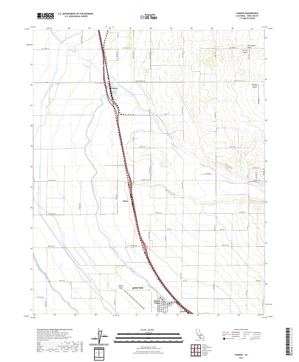
2021 Map of Famoso
USGS Topo · Published 2021About this map
Agricultural infrastructure and aviation history define this section of the Central Valley north of Bakersfield. The landscape is heavily marked by the water management systems of the Friant-Kern Canal, Lerdo Canal, and Calloway Canal, which irrigate the extensive grid of orchards and fields. Small settlements like Famoso, Slater, and Cawelo align with major transportation corridors, including the Famoso Porterville Hwy. A significant portion of the map is dedicated to aviation, featuring Shafter-Minter Field and Minter Village, the latter of which suggests a residential area developed around the airfield's activities. In the northeast, Poso Creek meanders toward the Poso-Kern County Airport, illustrating the coexistence of natural drainage and modern regional infrastructure in Kern County's highly developed agricultural interior.
Find a feature on this map
54 named features on this map. Tap any name to fly to it.
Don’t see what you’re looking for? This feature index may not catch every label — zoom into the map to look around manually.
Map Details
Editions of this 2021 Famoso Map
This is the sole edition of this map. No revisions or reprints were ever made.
Other maps of this area

1906 · Bakersfield
USGS Topo · 1:62,500

1910 · Buena Vista Lake
USGS Topo · 1:125,000

1912 · Buena Vista Lake
USGS Topo · 1:125,000

1927 · McFarland
USGS Topo · 1:31,680

1930 · McFarland
USGS Topo · 1:31,680

1930 · Wasco
USGS Topo · 1:31,680

1930 · Pond
USGS Topo · 1:31,680

1930 · Famoso
USGS Topo · 1:31,680

1930 · Rosedale
USGS Topo · 1:31,680

1930 · Oildale
USGS Topo · 1:31,680