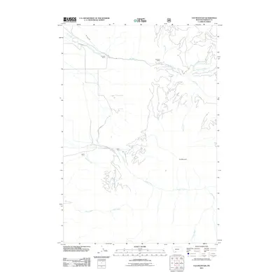
2011 Map of Fan Mountain
USGS Topo · Published 2011About this map
Fan Mountain dominates the eastern elevation of this Madison County landscape, where the high ridges of the Madison Range give way to a network of drainages and ranching outposts. Settled activity is concentrated along the northern corridor following Jack Creek, where the H Lazy B Ranch and Diamond Ranch are established. Water management is a central theme of this terrain, evidenced by the Jack Creek Ditch and H Lazy Ditch which divert mountain runoff for agricultural use. To the southwest, the Lawton Ranch sits near the headwaters of McDeed Creek. The geography is defined by a series of significant tributaries, including Aspen Creek, Cedar Creek, and Levi Creek, all flowing toward the lower valleys. This 2011 survey documents a sparsely populated but managed mountain environment, where road access like Jack Creek Rd remains vital for connecting isolated ranch properties to the wider region.
Find a feature on this map
17 named features on this map. Tap any name to fly to it.
Don’t see what you’re looking for? This feature index may not catch every label — zoom into the map to look around manually.
Map Details
Editions of this 2011 Fan Mountain Map
This is the sole edition of this map. No revisions or reprints were ever made.
Other maps of this area

1888 · Three Forks
USGS Topo · 1:250,000

1894 · Three Forks
USGS Topo · 1:250,000

1895 · Three Forks
USGS Topo · 1:250,000

1947 · Bozeman
USGS Topo · 1:250,000

1948 · Bozeman
USGS Topo · 1:250,000

1949 · Ennis
USGS Topo · 1:62,500

1950 · Cameron
USGS Topo · 1:62,500

1950 · Spanish Peaks
USGS Topo · 1:62,500

1950 · Sphinx Mountain
USGS Topo · 1:62,500

1955 · Bozeman
USGS Topo · 1:250,000