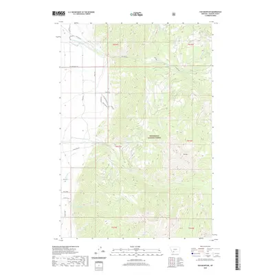
2020 Map of Fan Mountain
USGS Topo · Published 2020About this map
The Beaverhead National Forest defines the eastern half of this Madison County landscape, where the prominent peak of Fan Mtn overlooks a network of high-elevation drainages. Water management is a central theme in the northwest, evidenced by the H-Lazy Ditch and Jack Cr Ditch, which redirect flow across the benches near Jack Creek Rd. The area is characterized by these complex water rights and irrigation systems serving the foothills below the forest boundary.
Find a feature on this map
38 named features on this map. Tap any name to fly to it.
Don’t see what you’re looking for? This feature index may not catch every label — zoom into the map to look around manually.
Map Details
Editions of this 2020 Fan Mountain Map
This is the sole edition of this map. No revisions or reprints were ever made.
Other maps of this area

1888 · Three Forks
USGS Topo · 1:250,000

1894 · Three Forks
USGS Topo · 1:250,000

1895 · Three Forks
USGS Topo · 1:250,000

1947 · Bozeman
USGS Topo · 1:250,000

1948 · Bozeman
USGS Topo · 1:250,000

1949 · Ennis
USGS Topo · 1:62,500

1950 · Cameron
USGS Topo · 1:62,500

1950 · Spanish Peaks
USGS Topo · 1:62,500

1950 · Sphinx Mountain
USGS Topo · 1:62,500

1955 · Bozeman
USGS Topo · 1:250,000