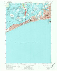
1969 Map of Far Rockaway
USGS Topo · Published 1984About this map
Jamaica Bay Wildlife Refuge sits at the heart of this coastal landscape, protecting a complex network of marshes like Big Egg Marsh and Jo Co Marsh amidst the urban expansion of Queens and Nassau counties. The southern peninsula is a dense corridor of residential life and leisure, stretching from the western end at Neponsit and Belle Harbor through the bustling boardwalk atmosphere of Rockaway Beach. This 1960s-era snapshot captures the peak of local institutions, showing numerous parochial schools such as St Rose of Lima Sch and St Marys Sch, alongside major landmarks like St Josephs Hospital and the amusement grounds of Rockaway Playland. The northern reaches transitions into the industrial and transit-focused areas of Inwood and Far Rockaway, where the New York City Transit Authority lines and the Powerplant near Motts Basin reflect the critical infrastructure supporting the Rockaway peninsula.
Find a feature on this map
97 named features on this map. Tap any name to fly to it.
Don’t see what you’re looking for? This feature index may not catch every label — zoom into the map to look around manually.
Map Details
Editions of this 1969 Far Rockaway Map
2 editions found
Other maps of this area

1889 · Brooklyn
USGS Topo · 1:62,500

1891 · Brooklyn
USGS Topo · 1:62,500

1897 · Brooklyn
USGS Topo · 1:62,500

1897 · Hempstead
USGS Topo · 1:62,500

1898 · Hempstead
USGS Topo · 1:62,500

1898 · Brooklyn
USGS Topo · 1:62,500

1899 · Hempstead
USGS Topo · 1:62,500

1900 · Brooklyn
USGS Topo · 1:62,500

1903 · Hempstead
USGS Topo · 1:62,500
1947 · Brooklyn
USGS Topo · 1:24,000