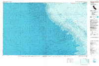
1993 Map of Farallon Islands
USGS Topo · Published 1993About this map
The Farallon Islands emerge from the depths of the Pacific at the edge of the Continental Escarpment, serving as a critical maritime landmark west of San Francisco. This topographic-bathymetric study, edited in 1993, highlights the stark isolation of the Farallon National Wildlife Refuge and Wilderness, where islands like Southeast Farallon Island and Maintop Island provide refuge far from the mainland. The inclusion of a Coast Guard Reservation underscores the strategic importance of these rocky outcroppings for regional navigation.
Find a feature on this map
15 named features on this map. Tap any name to fly to it.
Don’t see what you’re looking for? This feature index may not catch every label — zoom into the map to look around manually.
Map Details
Editions of this 1993 Farallon Islands Map
This is the sole edition of this map. No revisions or reprints were ever made.
Other maps of this area

1916 · Point Reyes
USGS Topo · 1:48,000

1918 · Point Reyes
USGS Topo · 1:62,500

1947 · Santa Rosa
USGS Topo · 1:250,000

1947 · San Francisco
USGS Topo · 1:250,000

1948 · San Francisco
USGS Topo · 1:250,000

1949 · Santa Rosa
USGS Topo · 1:250,000

1953 · Drakes Bay
USGS Topo · 1:24,000
1954 · Point Reyes
USGS Topo · 1:62,500

1955 · San Francisco
USGS Topo · 1:250,000

1956 · San Francisco
USGS Topo · 1:250,000