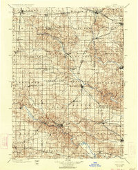
1900 Map of Farley
USGS Topo · Published 1934About this map
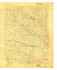
The Maquoketa River and the Wapsipinicon River carve a distinct agricultural and industrial landscape across Eastern Iowa in this late 19th-century survey. Rail networks dominated the regional economy at this time, evidenced by the convergence of the Chicago Milwaukee and St. Paul R. R. and the Illinois Central R. R. near key hubs like Farley and Manchester. Smaller settlements such as Hopkinton, Cascade, and Delhi are documented before significant twentieth-century modernization, showing their relationship to the river forks and local topography.
Find a feature on this map
90 named features on this map. Tap any name to fly to it.
Don’t see what you’re looking for? This feature index may not catch every label — zoom into the map to look around manually.
Map Details
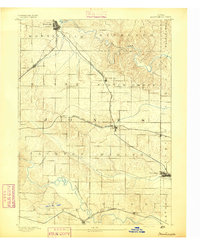
Editions of this 1900 Farley Map
4 editions found

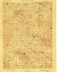
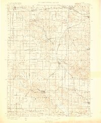
Other maps of this area

1887 · Cedar Rapids
USGS Topo · 1:62,500

1888 · Marion
USGS Topo · 1:62,500

1889 · Tipton
USGS Topo · 1:62,500

1889 · Marion
USGS Topo · 1:62,500

1890 · Tipton
USGS Topo · 1:62,500

1890 · Anamosa
USGS Topo · 1:62,500
1891 · Monticello
USGS Topo · 1:62,500

1891 · Mechanicsville
USGS Topo · 1:62,500

1891 · Cedar Rapids
USGS Topo · 1:62,500
1891 · Baldwin
USGS Topo · 1:62,500