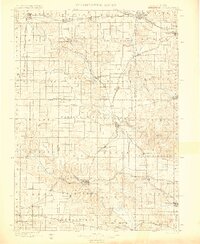
1900 Map of Farley
USGS Topo · Published 1900About this map
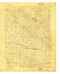
Anamosa and Manchester anchor this Eastern Iowa landscape at the close of the 19th century, a region defined by its critical river junctions and a dense web of early rail lines. The Maquoketa River and its North Fork and South Fork tributaries carve through the terrain, supporting numerous valley settlements like Monticello, Worthington, and the hamlet of Rockville. To the southwest, the Wapsipinicon River passes Stone City and Waubeck, while the surrounding prairie is partitioned by the Illinois Central RR and the Chicago Milwaukee and St Paul RR. This survey illustrates the intricate infrastructure of the 1890s, where small railroad junctions like Farley and Center Junction served as vital conduits for the agricultural economy. The map also records early township divisions across Delaware, Dubuque, Jones, and Linn counties.
Find a feature on this map
61 named features on this map. Tap any name to fly to it.
Don’t see what you’re looking for? This feature index may not catch every label — zoom into the map to look around manually.
Map Details
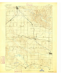
Editions of this 1900 Farley Map
4 editions found

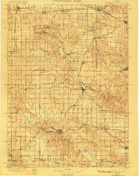
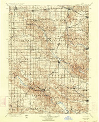
Other maps of this area

1887 · Cedar Rapids
USGS Topo · 1:62,500

1888 · Marion
USGS Topo · 1:62,500

1889 · Tipton
USGS Topo · 1:62,500

1889 · Marion
USGS Topo · 1:62,500

1890 · Tipton
USGS Topo · 1:62,500

1890 · Anamosa
USGS Topo · 1:62,500
1891 · Monticello
USGS Topo · 1:62,500

1891 · Mechanicsville
USGS Topo · 1:62,500

1891 · Cedar Rapids
USGS Topo · 1:62,500
1891 · Baldwin
USGS Topo · 1:62,500