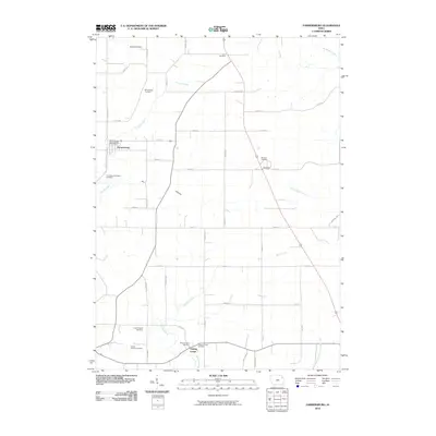
2010 Map of Farmersburg
USGS Topo · Published 2010About this map
Farmersburg serves as the primary hub of this Clayton County landscape, where the Farmersburg Post Office anchors a community defined by its rolling topography and network of seasonal waterways. The drainage patterns are intricate, featuring the winding Sny Magill Creek in the northeast and the branching Dry Mill Creek near the southern boundary. This 2010 survey reveals a high density of rural burial sites, which provide significant genealogical value for the area. Notable locations include the National Cemetery and Zion Lutheran Cemetery, along with smaller family or church-affiliated plots like the Winkawitsch Cemetery and the Colony Catholic Cemetery. The map also preserves the location of Bismark Station and the distinctive Dry Hollow formation. The grid of county roads, such as Hickory Ave and Harness Rd, connects these scattered homesteads and landmarks, illustrating the enduring agricultural character of the region during the early 21st century.
Find a feature on this map
46 named features on this map. Tap any name to fly to it.
Don’t see what you’re looking for? This feature index may not catch every label — zoom into the map to look around manually.
Map Details
Editions of this 2010 Farmersburg Map
This is the sole edition of this map. No revisions or reprints were ever made.
Other maps of this area

1902 · Elkader
USGS Topo · 1:125,000

1903 · Waukon
USGS Topo · 1:125,000

1929 · Prairie Du Chien
USGS Topo · 1:62,500

1932 · Prairie Du Chien
USGS Topo · 1:62,500

1958 · La Crosse
USGS Topo · 1:250,000

1959 · Dubuque
USGS Topo · 1:250,000

1961 · Dubuque
USGS Topo · 1:250,000

1961 · La Crosse
USGS Topo · 1:250,000

1962 · Dubuque
USGS Topo · 1:250,000

1962 · Clayton
USGS Topo · 1:24,000