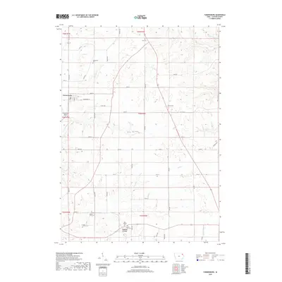
2018 Map of Farmersburg
USGS Topo · Published 2018About this map
Farmersburg and Clayton Center anchor this portion of Clayton County, illustrating a landscape defined by its agricultural layout and deep-seated community history. The area is notable for its numerous burial sites, which suggest the early denominational and ethnic roots of the region. Notable examples include the Zion Lutheran Cem, Colony Catholic Cem, and the National Cem. These sites, along with family-named landmarks like Winkawitsch Cem and Giard Cem, provide a valuable resource for genealogists tracing local lineage.
Find a feature on this map
52 named features on this map. Tap any name to fly to it.
Don’t see what you’re looking for? This feature index may not catch every label — zoom into the map to look around manually.
Map Details
Editions of this 2018 Farmersburg Map
This is the sole edition of this map. No revisions or reprints were ever made.
Other maps of this area

1902 · Elkader
USGS Topo · 1:125,000

1903 · Waukon
USGS Topo · 1:125,000

1929 · Prairie Du Chien
USGS Topo · 1:62,500

1932 · Prairie Du Chien
USGS Topo · 1:62,500

1958 · La Crosse
USGS Topo · 1:250,000

1959 · Dubuque
USGS Topo · 1:250,000

1961 · Dubuque
USGS Topo · 1:250,000

1961 · La Crosse
USGS Topo · 1:250,000

1962 · Dubuque
USGS Topo · 1:250,000

1962 · Clayton
USGS Topo · 1:24,000