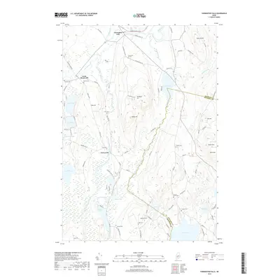
2018 Map of Farmington Falls
USGS Topo · Published 2018About this map
The Sandy River and Wilson Stream define the agricultural and residential landscape of this central Maine region. The village of Farmington Falls sits at a prominent bend in the river, while the settlement of Chesterville occupies a central position amidst a network of ponds and wetlands, including North Pond, Norcross Pond, and Egypt Pond. The terrain is marked by distinct elevations such as Zion Hill, Blabon Hill, and Cape Cod Hill, which overlook a high concentration of small family and community burial grounds.
Find a feature on this map
89 named features on this map. Tap any name to fly to it.
Don’t see what you’re looking for? This feature index may not catch every label — zoom into the map to look around manually.
Map Details
Editions of this 2018 Farmington Falls Map
This is the sole edition of this map. No revisions or reprints were ever made.
Other maps of this area

1892 · Augusta
USGS Topo · 1:62,500

1894 · Norridgewock
USGS Topo · 1:62,500

1898 · Norridgewock
USGS Topo · 1:62,500

1910 · Livermore
USGS Topo · 1:62,500

1912 · Livermore
USGS Topo · 1:62,500

1924 · Farmington
USGS Topo · 1:62,500

1941 · Livermore
USGS Topo · 1:62,500

1941 · Augusta
USGS Topo · 1:62,500

1943 · Augusta
USGS Topo · 1:62,500

1943 · Norridgewock
USGS Topo · 1:62,500