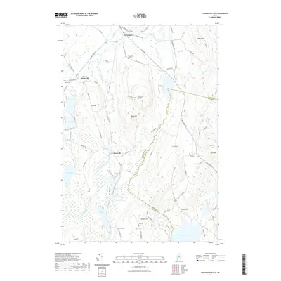
2021 Map of Farmington Falls
USGS Topo · Published 2021About this map
Farmington Falls anchors the northern reaches of this Maine landscape, where the Sandy River winds through the hills of Franklin and Kennebec counties. The settlement patterns follow the winding path of McCurdy Stream and Wilson Stream, linking the villages of North Chesterville and Chesterville. This modern survey reveals a region deeply rooted in its local heritage, evidenced by the numerous family and community burial grounds such as Webster Cem, Zion Hill Cem, and Seaveys Corner Cem.
Find a feature on this map
94 named features on this map. Tap any name to fly to it.
Don’t see what you’re looking for? This feature index may not catch every label — zoom into the map to look around manually.
Map Details
Editions of this 2021 Farmington Falls Map
This is the sole edition of this map. No revisions or reprints were ever made.
Other maps of this area

1892 · Augusta
USGS Topo · 1:62,500

1894 · Norridgewock
USGS Topo · 1:62,500

1898 · Norridgewock
USGS Topo · 1:62,500

1910 · Livermore
USGS Topo · 1:62,500

1912 · Livermore
USGS Topo · 1:62,500

1924 · Farmington
USGS Topo · 1:62,500

1941 · Livermore
USGS Topo · 1:62,500

1941 · Augusta
USGS Topo · 1:62,500

1943 · Augusta
USGS Topo · 1:62,500

1943 · Norridgewock
USGS Topo · 1:62,500