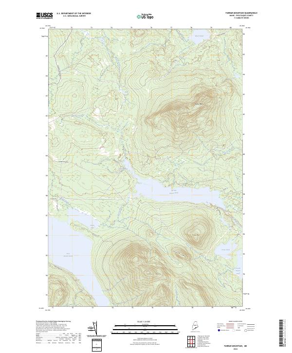
2024 Map of Farrar Mountain
USGS Topo · Published 2024About this map
Deep woodlands and isolated water bodies define this portion of Piscataquis County, where the Roach River connects a chain of significant glacial lakes. The terrain is dominated by prominent elevations such as Farrar Mtn and Shaw Mtn, which rise sharply above the basin of Second Roach Pond. This landscape is primarily accessible via logging and forest roads like Baxter State Park Rd and Frenchtown Rd, reflecting the region's enduring character as a managed timberland and wilderness retreat. Smaller features like North Inlet and Hinckley Cove provide specific points of reference for those tracing the shoreline of the Roach Ponds. The network of brooks, including Bear Pond Brook and Hinckley Brook, illustrates the intricate drainage patterns of the Maine north woods.
Find a feature on this map
27 named features on this map. Tap any name to fly to it.
Don’t see what you’re looking for? This feature index may not catch every label — zoom into the map to look around manually.
Map Details
Editions of this 2024 Farrar Mountain Map
This is the sole edition of this map. No revisions or reprints were ever made.
Other maps of this area

1952 · Jo-Mary Mountain
USGS Topo · 1:62,500

1952 · First Roach Pond
USGS Topo · 1:62,500

1954 · Grant Farm
USGS Topo · 1:62,500

1954 · Harrington Lake
USGS Topo · 1:62,500

1954 · Millinocket
USGS Topo · 1:250,000

1958 · Millinocket
USGS Topo · 1:250,000

1960 · Millinocket
USGS Topo · 1:250,000
1977 · Big Spencer Mountain
USGS Topo · 1:24,000
1977 · Number Four Mountain
USGS Topo · 1:24,000
1977 · Kokadjo
USGS Topo · 1:24,000