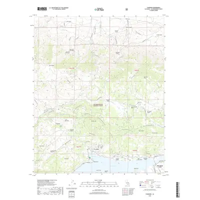
2018 Map of Fawnskin
USGS Topo · Published 2018About this map
Fawnskin sits at the heart of this mountain landscape, overlooking the north shore of Big Bear Lake within the San Bernardino National Forest. This modern record of the San Bernardino Mountains highlights the intricate network of forest routes and historic pathways, most notably the Pacific Crest National Scenic Trail as it winds across Bertha Ridge and past Delamar Mtn. The terrain is defined by deep drainages like Arctic Canyon and Bousic Canyon to the north, which give way to the high-elevation basins of Holcomb Valley and Upper Holcomb Valley. For those tracing local history, the map precisely identifies landmarks such as the Wilbur Grave near Van Dusen Canyon and the distinct geography of Hanna Flat. From the sheltered waters of Grout Bay to the heights of Grays Peak, the map documents the relationship between recreation-driven development and the enduring wilderness of the San Bernardino range.
Find a feature on this map
118 named features on this map. Tap any name to fly to it.
Don’t see what you’re looking for? This feature index may not catch every label — zoom into the map to look around manually.
Map Details
Editions of this 2018 Fawnskin Map
This is the sole edition of this map. No revisions or reprints were ever made.
Other maps of this area

1899 · Redlands
USGS Topo · 1:62,500

1901 · Southern California Sheet No. 1
USGS Topo · 1:250,000

1901 · Redlands
USGS Topo · 1:62,500

1902 · Deep Creek
USGS Topo · 1:62,500

1902 · San Gorgonio
USGS Topo · 1:125,000

1904 · Southern California Sheet No. 1
USGS Topo · 1:250,000

1947 · Lucerne Valley
USGS Topo · 1:62,500

1949 · Lucerne Valley
USGS Topo · 1:62,500

1953 · San Bernardino
USGS Topo · 1:250,000
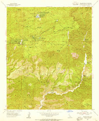
1953 · Keller Peak
USGS Topo · 1:24,000