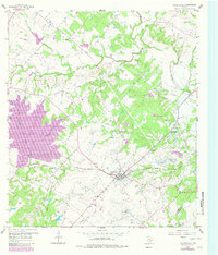
1958 Map of Fayetteville
USGS Topo · Published 1982About this map
Fayetteville serves as the central hub of this South Central Texas landscape, where the Missouri Kansas Texas railroad line cuts a path through the rolling terrain toward Tamberg. This 1958 survey, updated with late-1970s aerial data, reveals a rural landscape anchored by historic congregations and burial grounds, including the Halimeck Cem Ch and Sweet Home Ch. To the west, the creation of Lake Fayette significantly altered the drainage of Cedar Creek, while a network of smaller waterways like Cummins Creek and Jones Creek continue to define the outlying agricultural areas. The presence of smaller communities like Roznov and Rek Hill, alongside family-named landmarks such as Ellers Cem and Big Spring Hill, provides a clear view of the settlement patterns in Fayette County before modern expansion further transitioned the local economy.
Find a feature on this map
31 named features on this map. Tap any name to fly to it.
Don’t see what you’re looking for? This feature index may not catch every label — zoom into the map to look around manually.
Map Details
Editions of this 1958 Fayetteville Map
Other maps of this area

1919 · Fayettsville
USGS Topo · 1:62,500

1919 · Giddings
USGS Topo · 1:62,500

1953 · Seguin
USGS Topo · 1:250,000

1954 · Austin
USGS Topo · 1:250,000

1956 · La Grange
USGS Topo · 1:62,500

1957 · Ellinger
USGS Topo · 1:24,000

1957 · La Grange East
USGS Topo · 1:24,000

1957 · Ammannsville
USGS Topo · 1:24,000

1958 · Seguin
USGS Topo · 1:250,000

1958 · Industry
USGS Topo · 1:24,000