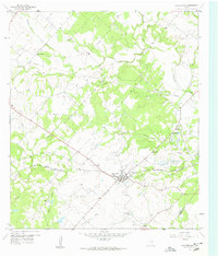
1958 Map of Fayetteville
USGS Topo · Published 1959About this map
The farming community of Fayetteville sits at the heart of this late-1950s landscape, where the Missouri Kansas Texas railroad cuts a straight line across the countryside through Tamberg. This region is defined by its deep spiritual and social roots, evidenced by the numerous country churches and family burial grounds scattered throughout the creek valleys. Notable sites include Big Spring Hill Ch, Sweet Home Ch, and the Halimecek Cem. To the northeast, Rek Hill and Roznov serve as additional settlement nodes amidst a network of watercourses like Cummins Creek and Spencer Pool Creek. The presence of several Gravel Pits and an official Historical Marker suggests an area where both natural resources and local heritage were actively recognized during this era of Texas history.
Find a feature on this map
27 named features on this map. Tap any name to fly to it.
Don’t see what you’re looking for? This feature index may not catch every label — zoom into the map to look around manually.
Map Details
Editions of this 1958 Fayetteville Map
Other maps of this area

1919 · Fayettsville
USGS Topo · 1:62,500

1919 · Giddings
USGS Topo · 1:62,500

1953 · Seguin
USGS Topo · 1:250,000

1954 · Austin
USGS Topo · 1:250,000

1956 · La Grange
USGS Topo · 1:62,500

1957 · Ellinger
USGS Topo · 1:24,000

1957 · La Grange East
USGS Topo · 1:24,000

1957 · Ammannsville
USGS Topo · 1:24,000

1958 · Seguin
USGS Topo · 1:250,000

1958 · Industry
USGS Topo · 1:24,000